Channel the power of vMAP’s full-featured web GIS system into smarter decision-making and increased evidential awareness of public needs. Handle safety problems with online interactive mapping and transform data streams into intelligent, actionable real-time visualisations. Locate emergencies and immediately deploy the required services, then analyse the results to tighten response times, streamline response procedures, and create effective pre-incident plans.
Manage public safety with vMAP
Manage public safety
Key features that improve your operations
Data Integration
Easily import or export data between vMAP and other systems.
Reports & Presentation
Generate customisable reports with defined data, templates and formats.
Multi-Level User Rights
Define user access at every level with specific function and content rights to the same datasets.
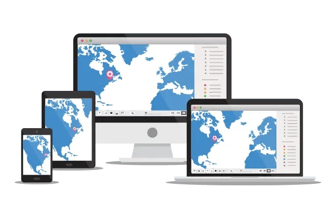
On-Premise & Online
Access vMAP via cloud-based solutions or install on private servers.
Crime
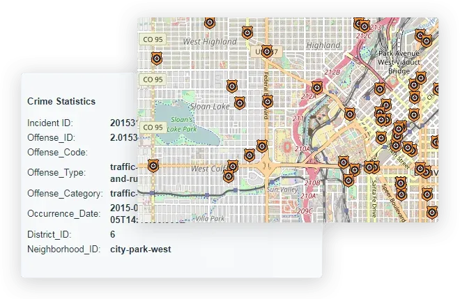
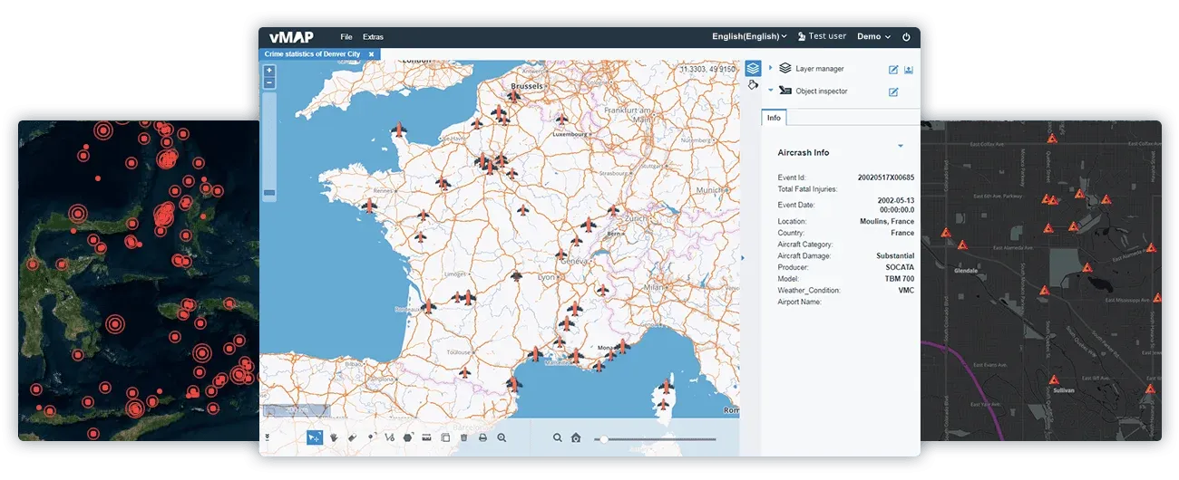
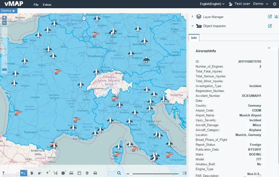
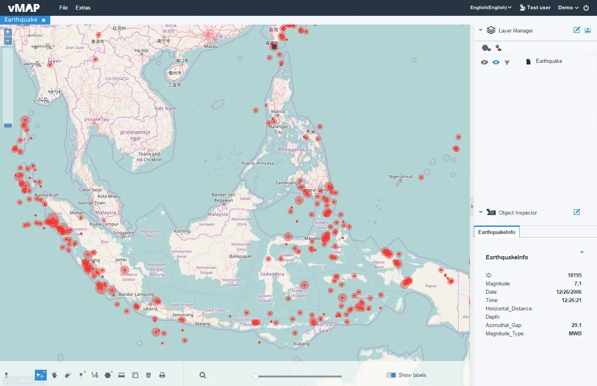
Crime Analysis
Analyse all crimes and disaster variables to locate and resolve high-risk areas. Filter by time, place and nature of crime to pinpoint incidents and events that require further investigation. Use data visualisations of past patterns to predict future events.
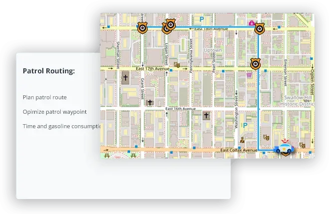
Patrolling Management
vMAP not only provides navigation for patrolling vehicles but generates daily patrol routes when inputting important waypoints. Vehicle profile management also enables time and gas consumption estimates.
Analysis
Analyse crime sites and areas and turn the data into viable crime prevention content.
Comparison
Comparison Pinpoint issues by comparing multiple factors of real-time and historic crime site data.
Filter
Quickly locate and display numerous crime types by setting multiple conditions.
Navigation
Optimise route navigation for patrolling and law enforcement vehicles.
Route Planning
Generate improved patrol routes including important waypoints.
Patrol Area Planning
Generate a patrol radius by setting drive or walk time and allowing free selection of patrolling areas and blocks.
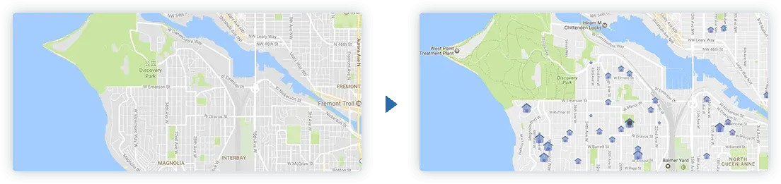
Incident Response
Be aware of occurring incidents and locate them instantly with interactive GIS mapping . Dispatch first responders, optimise possible supply routes, identify vulnerable areas and develop detailed evacuation plans with vMAP’s vivid real-time data relays.

Identify Locations
Immediately identify where the incident is occurring in the region with real-time data viewable on the maps. Share a real-time situation to allow for a more knowledgeable and safe response.

Confirm Affected Areas
Identify areas needing immediate evacuation by generating custom map polygons, then informing the services needed.

Rescue Routing
Optimise supply and service routes by quickly setting rescue points, breaks and vehicle profiles. Calculate and share with the relevant departments the most efficient routes to rescue sites.

Incident Awareness
Transform incident data into geospatial intelligence for real-time response, situational awareness, impact understanding and analysis.
Damage Assessment
Assess and analyse incident levels with rich interactive map data, maximise use of limited resources and effectively prioritise recovery efforts.

Damage Viewing
Map damaged infrastructures, affected populations and manage resources to more efficiently coordinate recovery efforts.

Future Research
Record and assess data to help subsequent analysis, research and impact reduction for future incidents.

Prepare Arrangements
Prepare more effectively for future incidents by knowing the vulnerable regions and having preparatory measures in place.
Data Integration
With a wide range of supported formats and connectors, it is easy to import and export public safety and geographic data between vMAP and other systems. This can be done in several ways, including via API.
KML
SHAPE
CSV
EXCEL
User Management
Two types of product version enable you to access vMAP from both internal safe networks and cloud-based networks.

On-Premise
Installed on-premise on a secure private network or server, with cloud access for office staff.

Online
Field personnel can access real-time disaster or crime data via computer or mobile device.
Reporting & User Management
Information summary and allocation are vital steps to public safety issues and aid preparation for future incidents, loss minimisation, and filing for study and research.

Flexible Collaboration
Share event reports both within and outside of your team, allowing the quickest delivery and collaboration times with on-site operations and office commanders. Self-defined data, templates and formats provide you with flexible options.

User Management
Incident analysis and rescue actions involve multiple units and teams. vMAP can always allocate the correct data to the correct personnel. Waste minimal resources and optimise your time management with no need to distribute various files by specific recipient.